Cameros Basin Integrated Study (Spain)
This course is a rare opportunity to access to rift lacustrine deposits similar to those that have been successfully explored in Eastern Africa.
- Course Type
Field Course - Duration
5 days - Thematic
Geosciences - Location
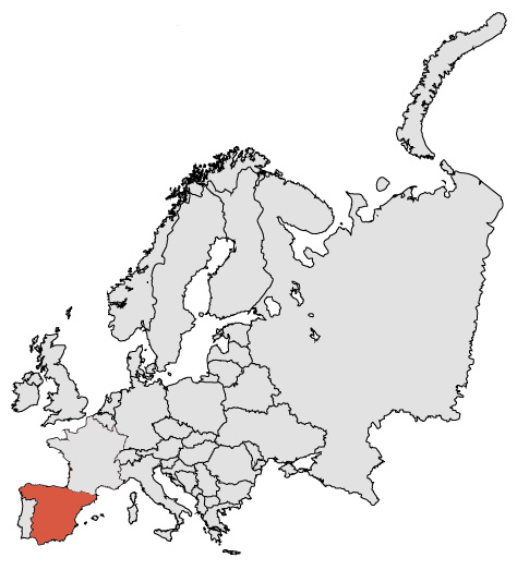
- Country
SPAIN -
Satisfaction rate
Why should you attend?
Because early rift sediments are rarely preserved at the surface of highly subsiding basins, it requires specific geodynamic situations to give access to their facies, geometries, and sedimentation processes.
The Cameros area not only offers this opportunity: its panoramas embrace also basin (and thus seismic) scale objects.
Moreover, these rare lacustrine outcrops (once correctly contextualized) could be used as analogues of Eastern Africa rifted Basins, where some recent discoveries have been done.
Main Objectives:
- This field course is focused on Cameros Basin multiscale reconstruction
- From the interpretation of satellite and aerial images to the analysis of rocks, outcrops & landscape, participants will discover a wide variety of methods, concepts and scale changes.
- Each analysis is done individually, then shared and discussed with the group, and finally integrated in a daily synthesis.
- At the end of the session, participants will fully understand the Cameros Basin structure, stratigraphy, geodynamics and evolution.
- They may then, be able to use it as a good analogic reference for Rift Exploration purposes, in Eastern Africa, or South Atlantic margins petroleum provinces, and elsewhere.
Learning Approach:
Learning-by-doing, based on extensive exercises during the field course.
A highly participative learning approach is applied during the training session.
Formal lectures are limited to summaries of key points.
Mutual interactions enhance 4G integration (geologist, geophysicist, reservoir and geomatics).
A regular knowledge progression is achieved through daily synthesis and FAQs sessions, in order to clarify individual doubts.
Moreover, an open minded and the positive communicative attitude of each participant would enhanced the final benefits of this training, for everybody.
HSE Requirements:
Each participant is required to provide a yearly medical certificate before attending this field course. Participants must be in good health and physical conditions to attend. Yet, every outcrop or panorama is easily accessible, and do not require specific training.
Attendees must also wear adapted shoes (suitable for pebbly hiking) and bring clothing for hot day time temperatures (sun hat, sun glasses, etc.), and potential rainfalls.
Course Agenda:
Day 1: Transfer to Logrono / Calahorra ? Satellite and aerial imagery study
Depending on participant arrival at airport (Madrid, San Sebastian, Biarritz or Pau) half a day is necessary for the transfer to the field course residential area, at Logrono / Calahorra (or Arnedo) Hotel.
Introduction to the course is acquired through maps and remote sensing images analysis and contextual description.
A program of investigation of the basin is built by the participants.
Key questions are addressed.
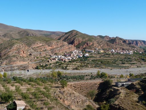
At the end of the day, the first outcrop studies are focused on the Soto de Cameros area. The Basin context is analysed linking maps, outcrops and panoramas.
The spectacular Cameros sedimentary series and tectonic features will rapidly convinced the participants of the uniqueness of this Cretaceous Basin.
Day 2: Cameros Basin margin characterization and initial infilling
From Arnedo to Arnedillo the regional geological context is analyzed by studying several outcropping formations and facies. Delineating the basin limits, is the main point of the day.
A thorough panoramic study is undertaken, linking geological maps and aerial images with field observations.
A final daily synthesis is proposed by the group.
Day 3: Cameros Basin dip section
From Arnedillo to Yanguas several outcrops and panoramas are studied focusing on the basin main infilling phases.
A daily synthesis is undertaken by the group.
Day 4: Cameros Basin strike section
From Yanguas to San Felices and back to Arnedillo, complementary outcrops and panoramas are related to the previous day program.
The daily conclusion will integrate dip and strike sections of the basin.
Day 5: Synthesis & Conclusion and transfer to the airport
The last morning is a class room session organized at the hotel to conclude and compare the acquired dataset with exploration case studies.
Transfer to the airport is scheduled in the afternoon.
")
")
")
")
")
")
")
")
")
Prerequisites
This course is for any geoscientist with a basic knowledge of geology, and any participant at bachelor or master level.
As for any synthesis study, more advanced professionals would be greatly interested by the topics envolved in each session.
However, an open minded and communicative attitude would enhanced the final benefits of this training.

